Introduction
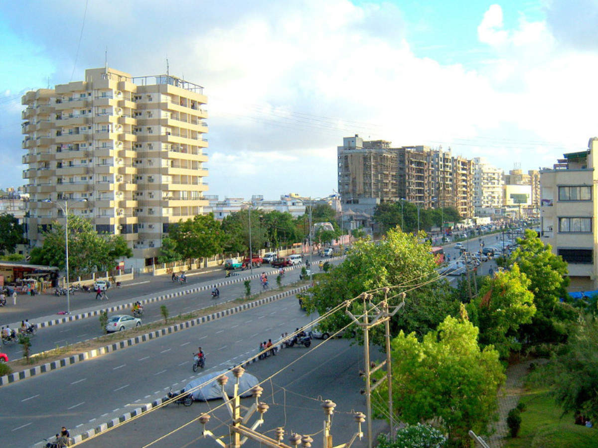
Rafah (Arabic: رفح Rafaḥ) is a Palestinian city in the southern Gaza Strip and the seat of the Rafah Governorate, Situated 30 kilometers southwest of Gaza City. Its population was 171,889 in 2017, but as of February 2024, around 1.4 million Palestinians were seeking refuge there as a result of ongoing wars. Egypt oversaw Rafah following the 1948 war in Palestine and established camps for refugees. In the Rafah massacre of 1956, 111 Palestinians were slain by Israeli soldiers. Israel conquered Rafah during the 1967 Six-Day War, destroying homes and killing people. Rafah was split between Gaza and Egypt after 1982, dividing families. In addition to housing the Yasser Arafat International Airport, which was in use from 1998 until it was destroyed by Israeli troops in 2001, it is the location of the Rafah Border Crossing, the sole crossing point between Egypt and Gaza.
Etymology
Ancient Egyptians referred to the city as Rpwḥw; Assyrians called it Rapiḫi or Rapiḫu; ancient Israelites called it Rāphiyaḥ; Greeks called it Rhaphíā; Romans called it Raphia; and the Arab Caliphate called it Rafh. Rafah (/ˈrɑ\fə/ (US) or /ˈraefə/ (UK)), which is derived from contemporary Arabic, is the most commonly used term in English. However, Raphiah (/rəˈfaɪə/) from ancient Hebrew and Rafah (/rəˈfiːə/) from modern Hebrew are sometimes used, particularly in historical settings such as the Battle of Raphiah.
Development
A border between British-ruled Egypt and Ottoman-ruled Palestine was drawn in 1906 by the Ottoman–British agreement, and it ran from Taba to Rafah. This border was upheld when Palestine was ruled by the British following World War I. Rafah developed as a minor border town by the middle of the 1930s and a significant British base during World War II. Rafah was in Egypt-occupied Gaza after 1949, ignoring the previous border. Israel occupied Rafah after capturing the Sinai and Gaza during the 1967 Six-Day War. Rafah is one of three border sites between Egypt and Israel, having been divided by families and properties as a result of the 1979 Israel-Egypt peace accord that gave Egypt back control of the Sinai.
Demographics
Rafah had 599 residents in 1922, 2,220 by 1945, and roughly 10,800 by 1982.
In Rafah and the nearby camp, there were 91,181 persons counted in the 1997 census, whereas Tall as-Sultan had 17,141 residents. With 50.5% of the population being male and 49.5% being female, refugees made up 80.3% of the total population.
Rafah had 71,003 inhabitants in 2006; Rafah camp had 59,983 and Tall as-Sultan had 24,418.
History
Bronze Age Raphia
The history of Rafah is quite old, going back thousands of years. It was the first halt on Pharaoh Shoshenq I’s campaign to the Levant in 925 BCE, and it was noted as Rph by Egyptian Pharaoh Seti I in 1303 BCE. It was the scene of Sargon II of Assyria’s triumph over the Egyptians in 720 BCE.
Hellenistic and Roman periods
The Battle of Raphia, involving approximately 100,000 men and hundreds of elephants, took place in 217 BCE between Ptolemy IV and Antiochus III. Rafah was later taken by Alexander Yannai and ruled by the Hasmoneans until it was rebuilt in 57 BCE during the reigns of Pompey and Gabinius. Rafah is shown on the Map of Madaba and mentioned in Strabo and the Antonine Itinerary.
Byzantine period
Rafah was a diocese during the Byzantine era, as shown by the discovery of Byzantine coins and ceramics. It was represented in the Council of Ephesus in 431 CE by Bishop Romanus. With a little Greek Orthodox population, it is nevertheless a titular see of the Roman Catholic Church today.
Early Muslim to Mamluk periods
After being taken over by ‘Amr ibn al-‘As’s Rashidun army in 635 CE, Rafah developed into a prominent commerce hub in the Early Muslim era. It was the last village in the Province of Syria on the road from Ramla to Egypt, and under the Umayyads and Abbasids, the southernmost frontier of Jund Filastin. There, a Samaritan and Jewish community settled in the ninth, tenth, and twelfth centuries. It was a thriving city until the 11th century, when it began to collapse and was eventually used as an Ayyubid postal station on the route to Egypt.
Ottoman and Egyptian period
British period
British forces took Rafah on 9 January 1917 and used it as a springboard for their first effort to take Gaza. Rafah’s population increased as a result of internal migration brought in by the British military presence. Rafah’s Muslim population increased from 599 in the 1922 census to 1,423 in the 1931 report. Rafah contained 40,579 dunams of land, comprising plantations, cultivated land, and uncultivable areas, and 2,220 Muslim residents according to the 1945 Village Statistics.
1948–1967
Egypt ruled the region following the 1948 Arab–Israeli War and established camps for refugees. During the Suez Crisis in 1956, the Israel Defense Force massacred 111 Palestinians, including 103 refugees, at Rafah. The situation is still open-ended. It was taken by Israeli forces in the 1967 Six-Day War. Twenty-three Palestinians were killed when the Israeli force destroyed 144 homes in the refugee camp in June 1967.
After 1967
Under General Ariel Sharon, the IDF demolished 500 homes in the camps for refugees in Rafah in 1971, forcing 4,000 people to flee their homes. Israel built houses for the refugees under the names Brazil and Canada. In May 2004, Ariel Sharon granted approval for yet another massive demolition, which earned him the moniker “the bulldozer.” Rafah remained divided after Israel withdrew from Gaza in 2005, which allowed smuggling tunnels to emerge.
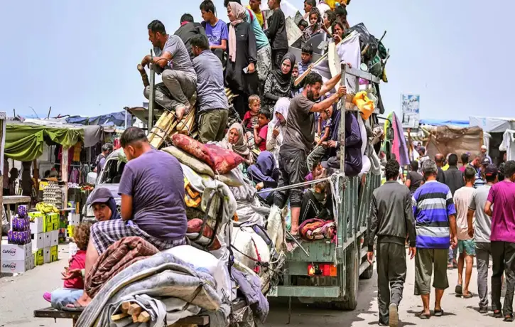
2023–2024 War in Gaza
Gaza was bombed by Israeli forces, forcing 1.4 million Palestinians to flee their homes. UN warned of a ground invasion with massive civilian casualties.
Rafah Border Crossing
The Border Crossing, the only route between Egypt and the Gaza Strip, is located in Rafah. It had been ruled by the Israeli military until 2005, when the Palestinian Authority took control of it. Since November 2005, it has been under the supervision of European Union monitors; on the Egyptian side, 750 Border Guards oversee operations in accordance with a 2005 agreement between Egypt and Israel.